
The World of Siliar
[si´ - lee - är]
In links, letters in parenthesis indicate type of membership required by pages.
Notes
Not all realms (orange) are depicted. Where they have been accounted for in stories, they are (mostly) included.
Last Update: 2020-12-18
Author Insight
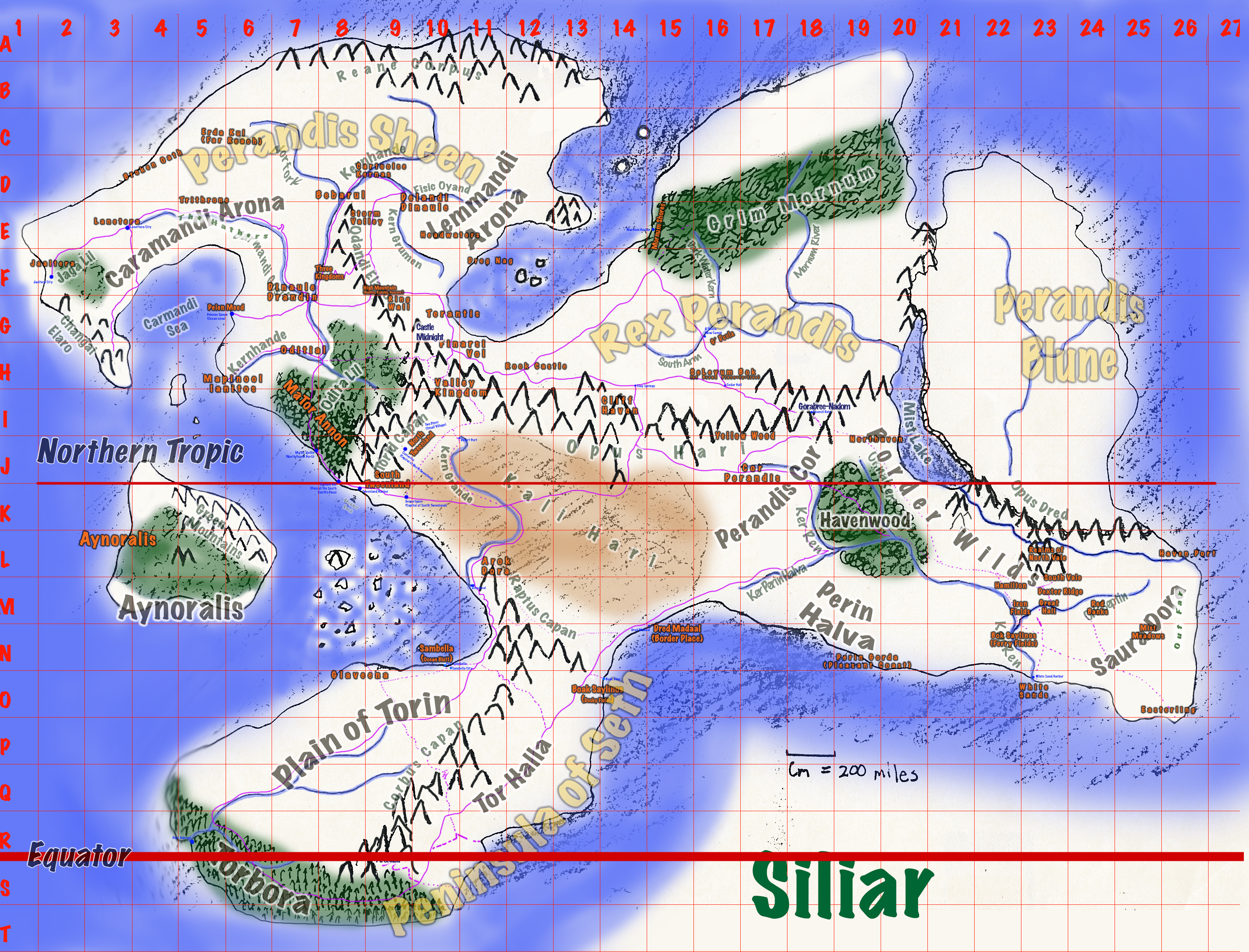
The original "world map" was drawn back around 1984 or 1985 by hand. It was laid out with the 200 X 200 mile grids, and then the naming process began. Over the years, the basic geography of the Siliar continent has remained unchanged. Layers and layers of history and details have grown on top of that original map.
Having a good foundation to work with is a vital means toward getting started on the right footing. From a solid geopolitical framework, realistic, believable stories can more easily emerge.
Notes
The oldest maps where hand-drawn using pencil. Later, they were overdrawn with ink, and by and by, colors were added. Many years later, they were scanned and the process of rendering them with color and legible fonts began.
The most detailed areas are those of central and eastern Perandis Sheen. Names on the map reflect the history of the people. The words emerge from the different languages of Siliar.