top of page


The World of Siliar
[si´ - lee - är]
In links, letters in parenthesis indicate type of membership required by pages.
The World of Siliar
Maps
The buttons (like this one ) will open more
detailed maps. (Reload the page to repeat the "locate" animation.
NOTE: The map functions (e.g. zoom) are limited by the screen size on mobile version.
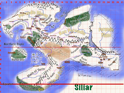
There are large maps below on which are the buttons that will open the more detailed maps. Clicking the detailed maps will zoom in to the highest level of detail.
It might interest some to know that the continental map was first drawn by Cameron around 1984 or so. Then, the area maps were drawn by both him and Bill over the next following years. Beginning in 1987, Bill continued to develop the maps and adapt them for the stories.

The Southeast Lands

I'm a paragraph. Click here to add your own text and edit me. It's easy.
More About Maps
If you are Interested in more information about the maps, check out the video below. Author, Bill Snodgrass, discusses the origins and evolution of the maps.
Since their inception, the maps of Siliar have changed in form, but not in function. They ground the action of the stories to the constraints of a world that developed in realistic way based on the geology of a realistic world.
Check out the video!
bottom of page